Education
Three-dimensional representations of a landscape are ideal teaching materials for geographic education. They are both easier to understand than maps and enable students to comprehend the concept of contour lines in topographic maps. Geological understanding can be simplified by using type reliefs showing geomorphologic sites like a glacier with its moraines, a fjord or a volcanic island, etc. But a terrain model can also easily familiarise the pupils with the surroundings of their place of living and the morphology of their country.
It is also possible to build a terrain model with pupils and a lot of easy techniques to create models exist [1].
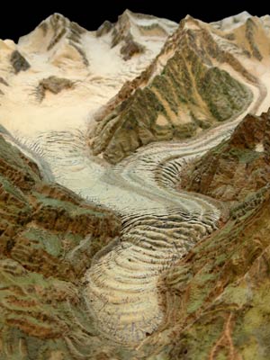
Type relief for use in schools,
Glacier, no real counterpart
1:18,000,40 x 61 cm , Albert Heim,
Glacier Garden Lucerne
Glacier, no real counterpart
1:18,000,
Glacier Garden Lucerne