Urban reliefs
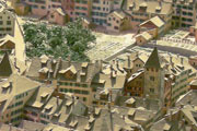
City of Zurich, Hochbaudepartement
Not only terrain can be miniaturized, but also single constructions like buildings can be represented. From time immemorial such models were used in Ancient Greece and Roman Empire. They were used both to study planned works and to illustrate existing buildings. For example, a model of a cathedral could be used to study the architecture of the building by stonemasons when repairing the building or altering it [1].
For strategic purposes, several separate building models were not suitable, so the whole city and its surroundings had to be modelled. Thus, the first terrain models were born.
In contrast to many other terrain models, the buildings and other man-made environs are constitutive of these models. Today they are often used for planning purposes. On a model, it is easy to depict the influence of a planned project on the existing environment. When presenting projects to the public, a model is the most convenient instrument.
Old city models have significant value in historical research; unlike more or less unaffected landscape, they underlie much faster changes during a specific period of time. Sometimes, models depicting a historic period are made later, using old city maps as a construction base.
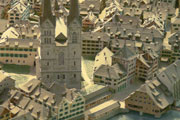
City of Zurich, Baugeschichtliches Archiv
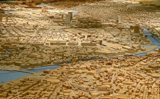
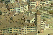
The underlying terrain is often formed using the layer method. The buildings are made from wood or plaster, but a lot of other materials may also be used. Nowadays, most urban models are generated using computer based techniques. A result is shown in the figure below.

[1] The first paragraph bases on Heydenreich, Ludwig Heinrich. Architekturmodell. In: Schmitt, Otto (ed.). Reallexikon zur deutschen Kunstgeschichte. Band 1. Stuttgart 1937. col.918-940.