Reliefs for navigation
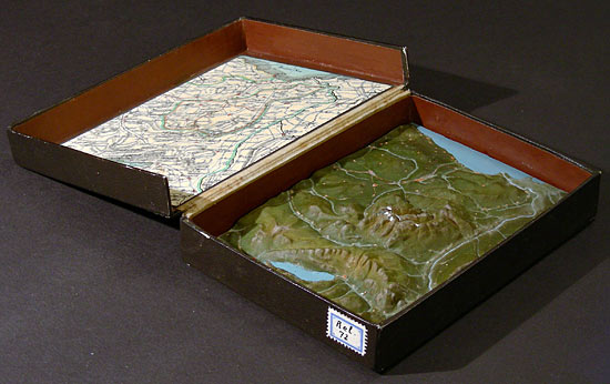
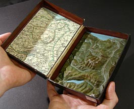
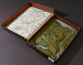
Relief of St. Gallen and Appenzell (Switzerland) as illustration of a map, 1:500,000, vertical scale 1:200,000, Carl August Schöll, about 1855,
Swiss Alpine Museum
Swiss Alpine Museum
A little pocket relief that could be taken along during a trip facilitated the navigation of people untrained in interpreting maps. Particularly before the circulation of contour maps, a little model of the terrain could help finding one's way in mountainous regions. Carl August Schöll (1810–1878) created such a relief based on a map of 1813 created by Heinrich Keller (1778–1862).