Military
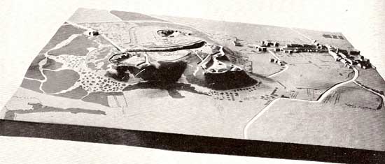
Picture from Chase p.108.
Terrain models were first used for military purposes. The relief model allows a quick overview of a certain area. In war, time is a crucial factor. This means that the relief of the area of interest must be prepared before a possible conflict. However, nowadays the computer based production of terrain models allows production even in very short time, assuming that the needed raw data including a digital terrain model already exist. A model of the landscape enables memorising the details much better than a map and minimises the risk of incorrect map reading. In addition the field of vision from each point is easily ascertained, something very important in war and not so easy to find out from a map. It is also possible to easily evaluate the coverage of a fire position.
Terrain models were used extensively in World War II, and during the Korean War plastic relief maps were used for the first time.
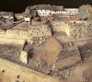
Picture from Roux p.68.